|
The secrets of Ynys Gorad Goch
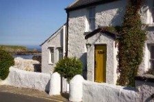
In the Menai Straits, between the Britannia Bridge and Telford’s Suspension Bridge, lies Ynys Gorad Goch, the largest of several islands, with a white-painted house perched comfortably above the high water mark.
At low tide, two weirs can be seen clearly, one to the north and the other to the south of Ynys Gorad Goch.
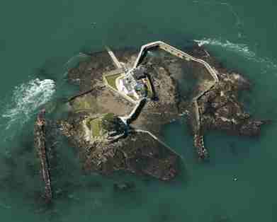
When it was found that this barrier blocked the ingress of fish on the subsequent flood tide, some arrangement had to be made to allow them to pass the barrier while the tide was flowing. This could be an opening in the wall which would be closed at high water.
A similar method could be the building of a barrier across the channel between a small island and the mainland. The fish could pass around the outside of the island, to be carried towards the shore on the flood, but held by the barrier when trying to make their way through the channel on the ebb.
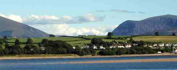
There were several such weirs along the Menai Straits, from Bangor to Caernarfon. The swift currents and the unusual combination of tides which meet near the Suspension Bridge created excellent conditions for this type of fishing.
These fisheries are very old, and the earliest known document relating to Ynys Gorad Goch is dated 1590.
At this time the island and its fishery was leased by the then Bishop of Bangor to a Thomas Fletcher of Treborth. He had to pay ‘Three pounds and besides one Barell full of hearinges at the tyme of the hearing fishinge’.
A later map refers to this as ‘Bishop’s Island’. There is a Bishop’s Room in part of the house which is an observation room, and above the centre window is a carving of a mitre, and below it, the inscription ‘I.R. 1808’.
This is a reference to John Randolph, Bishop of Bangor at the time. The story goes that Bishops would come to meditate here.
The island and fishing rights were eventually sold by the Ecclesiastical Commissioners in 1988, and from that time it has had a succession of private owners.
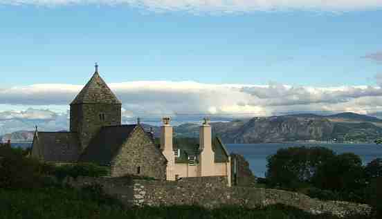
Tradition has it that Gorad Goch supplied fish, fresh or smoked herring, to several monasteries in Anglesey since the 13th century.
In the early 20th century, it was fashionable for visitors to cross to the island to enjoy whitebait teas. They would walk down to the shore by a footpath through the Coed Môr woods, ring a bell placed on the shore for the purpose, and a boat would put out from the island to collect them.
The Gorad Whitebait Tea consisted of a pot of tea, brown bread and butter, and whitebait ‘fried in a basket’, priced one shilling. During very high tides in the spring and autumn, the water sometimes reaches the outside of the house on the front and west sides. During one occupancy, in 1963, an attempt was made to plant a garden on Ynys Gorad Goch, on the north and east side of the curing tower. It had previously been a dumping-ground for rubbish.
It was divided into two separate areas, a rock garden and a herb garden. Because there was little soil, peat was added, and buckets of silt brought by the tide, and seaweed and compost.
The gardeners had permission to collect leaf-mould from the Anglesey shore. After using silt, it was necessary to wait until the rain had washed away the salt before planting.
The gardeners found that dianthus, androsace, alyssum, campanula and cheranthus all flourished.
Helianthemums, mimulus, alpine phlox, primulas and polyanthus and saxifrage also did well.
Needlesss to say, there were predators - snails, the wind, and terns were all a menace. But the herb garden produced a wonderful crop of parsley the first year.
Directions: To see Ynys Gorad Goch at close quarters from land, take the woodland path from the Britannia Bridge-Menai Bridge main road, to the east of the slip road. This leads down steeply to the shore, to the one-time landing place where the bell was hung to call the boat.
This article is taken from the book “Anglesey Sketches” by Margaret Hughes and is published with kind permission of Garreg Gwalch, Llanrwst, Tel: (01492) 642031
|


